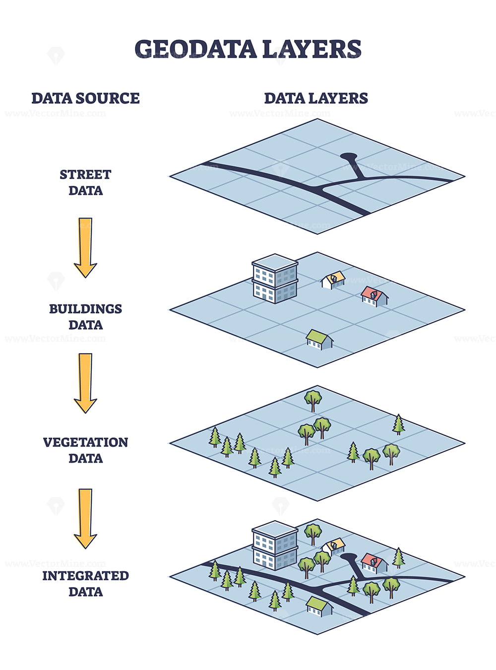
Geodata layers example with map info structure elements outline diagram
€7.99
This product includes:

1. Editable Vector .AI file
Compatibility:
Adobe Illustrator CC
Includes Editable Text Font SuezOne (Under Free Open Font License)

2. Editable Vector .EPS-10 file
Compatibility:
Most Vector Editing Software

3. High-resolution JPG image
3700 x 5000 px

License terms in short:
Use for everything except reselling item itself.
Read a full license here
Meta description: Geodata layers example with map info structure elements outline diagram. Topography information with street, buildings, vegetation and integrated data instruments vector illustration. Satellite view.


